How to Map Unmarked Graves in Cemeteries
Have the Graves in Your Cemetery Located by a Nationally Recognized Expert
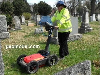
GeoModel, Inc. can locate known (marked) and unmarked graves in cemeteries using Ground Penetrating Radar (GPR). During the grave detection survey, the located graves are marked on the ground with paint. These grave location marks may be subsequently plotted on an existing map of the cemetery, if available. For large cemeteries, a local surveying company can plot the graves on a map.
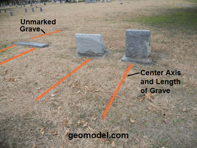
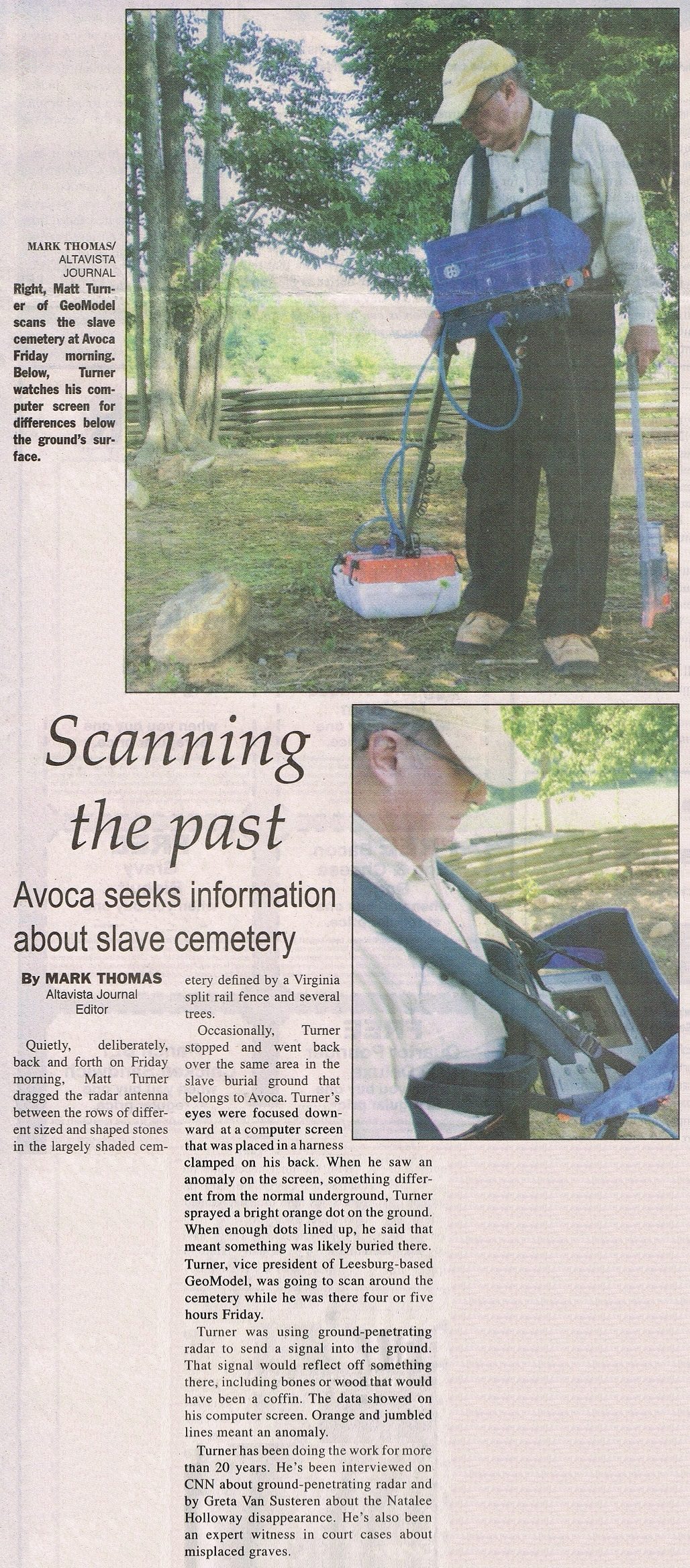
Some cemeteries are hundreds of years old and unmarked graves can be common. Misplaced or poorly located headstones or markers can further complicate matters. Records are often vague, lost, or incomplete and there may be questions about the precise extent of a cemetery. There is often no surface expression of the burial location. Due to the sensitivity of these sites, the challenge is to explore the subsurface without disturbing the soil and burials. GPR is the only viable non-destructive method used for grave detection.
- The coffin or casket (wood, metal, lead lined, etc) or vault
- Disturbed ground structure and excavation features
- Movement or voids caused by collapse of the coffin or casket
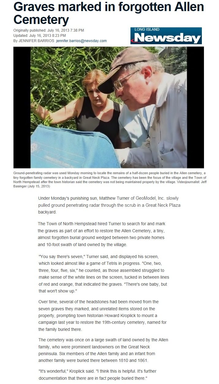
Recently, GeoModel, Inc. carried out a grave detection survey at the Gallatin City Cemetery in Gallatin, Tennessee. The survey was conducted in the older slave section to locate unmarked graves in order to identify and accurately mark the locations of each grave. Hundreds of unmarked graves were detected in the 4-acre area that dates back to the 1800’s. The link to a video on NewsChannel5 is below, and an article in the Tennessean newspaper is further below.


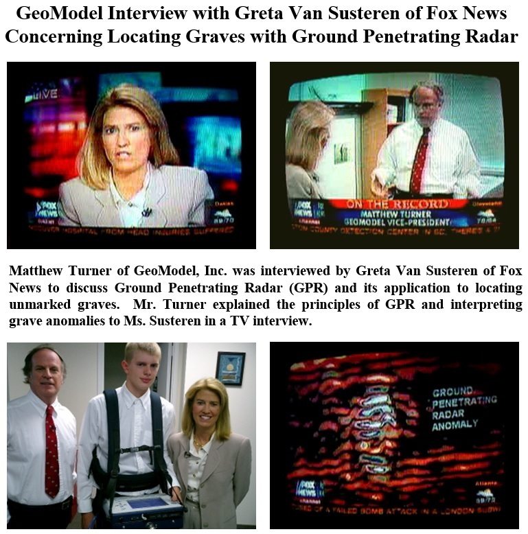
A GeoModel, Inc. cemetery survey or grave detection survey is conducted by an experienced Licensed Professional with over 20 years of grave locating experience. This professional is nationally recognized and has been in many newspapers nationwide (See articles below), and has been interviewed by Greta Van Susteren about using GPR to locate unmarked graves:

How Accurate is Ground Penetrating Radar to Detect an Unmarked Grave for Cemetery Mapping?
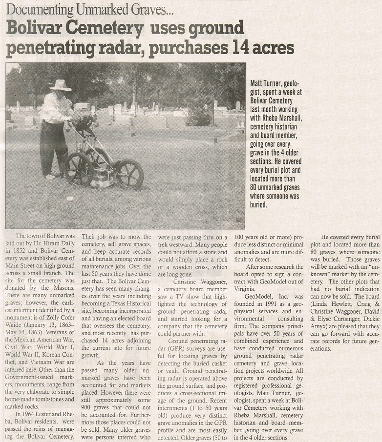
Recent interments (1 to 50 years old) generally produce very distinct grave anomalies in the GPR profile and are most easily detected. Older graves (50 to 200 years old or more) produce less distinct or minimal anomalies and are more difficult to detect. Remains of burials are easier to locate in sandy soils that do not contain tree roots or rocks.
In cases where a vault or casket does not exist, or where the casket has completely deteriorated, GeoModel, Inc. can examine the GPR data for disturbed soil, grave trenches, or other indications of the burial.
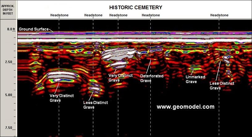
Many cemeteries have unmarked gravesites, old burials, and more recent burials, as shown in the ground penetrating radar image above from the historic Arlington Cemetery.
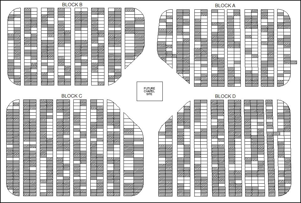
The position of detected graves can be marked on the ground or GeoModel, Inc. can provide cemetery mapping by plotting the locations of graves on aerial photos or mapping the graves on CAD drawings providing the client with clear, easy to understand results. Some cemetery associations prefer GeoModel to provide cemetery mapping (grave mapping) which results in a cemetery map that has the occupied and vacant grave plots (spaces) mapped on their existing cemetery grave map, as shown below.
GeoModel, Inc. News Articles Pertaining to Grave Locating and Cemetery Mapping
GeoModel, Inc. has conducted numerous unmarked grave detection and cemetery surveys that have significant interest to the local community, foundations, or government agencies. Below are a few of the unmarked grave locating and cemetery mapping articles.
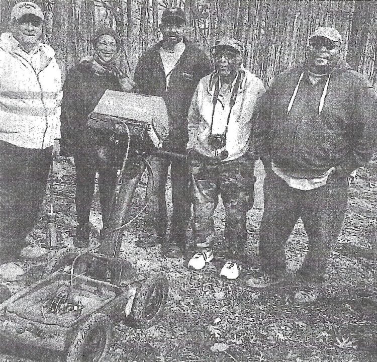
GeoModel, Inc. conducted a survey for the South Lake Tahoe section of the DAR organization to locate unmarked graves at the old Al Tahoe Pioneer Cemetery in South Lake Tahoe, California. A photo of the field crew is shown below, including Matt Turner, the GeoModel, Inc. professional GPR grave locator:

Matt Turner of GeoModel, Inc. conducted a Ground Penetrating Radar (GPR) survey for the Historic Stanton Family Cemetery in Buckingham County, Virginia. To read the entire News article, click here.
A recent GeoModel, Inc. cemetery survey to locate unmarked graves was featured in the Inside Nova newspaper on-line. The article is shown below:

Another recent GeoModel, Inc. cemetery survey was featured in the Tennessean Newspaper on-line, and is provided below: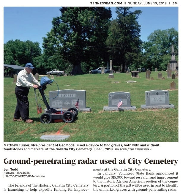
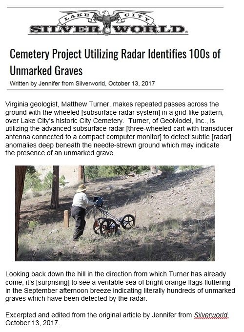
Another grave location article is featured in our geomodel.com/news section, and is also included below:

GeoModel, Inc. recently conducted a ground penetrating radar survey to locate unmarked graves at the Waterford Cemetery in Waterford, Virginia. The grave locating survey was featured on the Waterford Union of Churches Cemetery website:
